Project
Community
News
My App
My maps
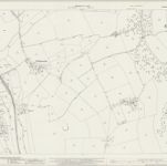
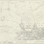
Hampshire & Isle of Wight XCVIII.SE - OS Six-Inch Map
1938
Ordnance Survey
1:11k
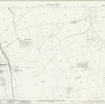
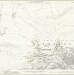
Hampshire & Isle of Wight XCVIII.SE - OS Six-Inch Map
1906
Ordnance Survey
1:11k
Hampshire & Isle of Wight XCVIII.SE - OS Six-Inch Map
1896
Ordnance Survey
1:11k
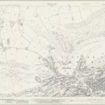
Shanklin
1793
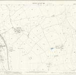
Hampshire and Isle of Wight XCVIII.15 (includes: Godshill; Niton; Ventnor) - 25 Inch Map
1939
Ordnance Survey
1:3k
Hampshire and Isle of Wight XCVIII.15 (includes: Godshill; Niton; Ventnor) - 25 Inch Map
1907
Ordnance Survey
1:3k
Hampshire and Isle of Wight XCVIII.15 (includes: Godshill; Niton; Ventnor) - 25 Inch Map
1896
Ordnance Survey
1:3k
Hampshire and Isle of Wight XCVIII.16 (includes: Godshill; Ventnor) - 25 Inch Map
1939
Ordnance Survey
1:3k
Hampshire and Isle of Wight XCVIII.16 (includes: Godshill; Ventnor) - 25 Inch Map
1907
Ordnance Survey
1:3k
Hampshire and Isle of Wight XCVIII.16 (includes: Godshill; Ventnor) - 25 Inch Map
1896
Ordnance Survey
1:3k
History
Old maps of Ventnor
Discover the past of Ventnor on historical maps
Old maps of Ventnor
Discover the past of Ventnor on historical maps
Explore Maps
Discover History
Parent places
Isle of Wight
Related places