Project
Community
News
My App
My maps
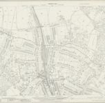
Hertfordshire XLIV.13 (includes: Harrow; Rickmansworth Urban; Ruislip; Watford Rural) - 25 Inch Map
1935
Ordnance Survey
1:3k
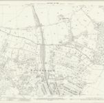
Hertfordshire XLIV.13 (includes: Harrow; Rickmansworth Urban; Ruislip; Watford Rural) - 25 Inch Map
1912
Ordnance Survey
1:3k
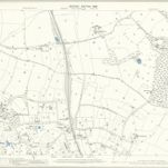
Middlesex V.13 (includes: Rickmansworth Urban; Ruislip; Watford Rural) - 25 Inch Map
1911
Ordnance Survey
1:3k
Middlesex V.13 (includes: Rickmansworth Urban; Ruislip; Watford Rural) - 25 Inch Map
1896
Ordnance Survey
1:3k
Hertfordshire XLIV.13 (includes: Harrow; Rickmansworth Urban; Ruislip; Watford Rural) - 25 Inch Map
1895
Ordnance Survey
1:3k
RAF Aerial Collection (1945 - 1949)
1947
RAF
1:10k
RAF Aerial Collection (1945 - 1949)
1946
RAF
1:5k
RAF Aerial Collection (1945 - 1949)
1946
RAF
1:5k
Hertfordshire XLIV.SW - OS Six-Inch Map
1938
Ordnance Survey
1:11k
Hertfordshire XLIV.SW - OS Six-Inch Map
1934
Ordnance Survey
1:11k
History
Old maps of Northwood, London
Discover the past of Northwood, London on historical maps
Old maps of Northwood, London
Discover the past of Northwood, London on historical maps
Explore Maps
Discover History
Parent places
Hillingdon
Related places